It all started when a high school friend posted an article from ESPN on Facebook, which links to City Prints Map Art, a company that makes monochromatic prints of maps with streets like look like veins. Here's a map of Appalachian State University (my undergrad alma mater):

I love minimalist monolithic art (is that a thing?) and I love maps. Add school colors and I would gladly drop $180 to buy this (my wife said no). When I shared this company's website on FB, I got a comment from a Texas friend who shared the online map archive at UT-Austin. After a few hours I got around to looking at the archive and realized they had historical maps from every state, so I clicked on North Carolina, and then found a more complete NC historical map archive and started looking at places I've lived and visited.
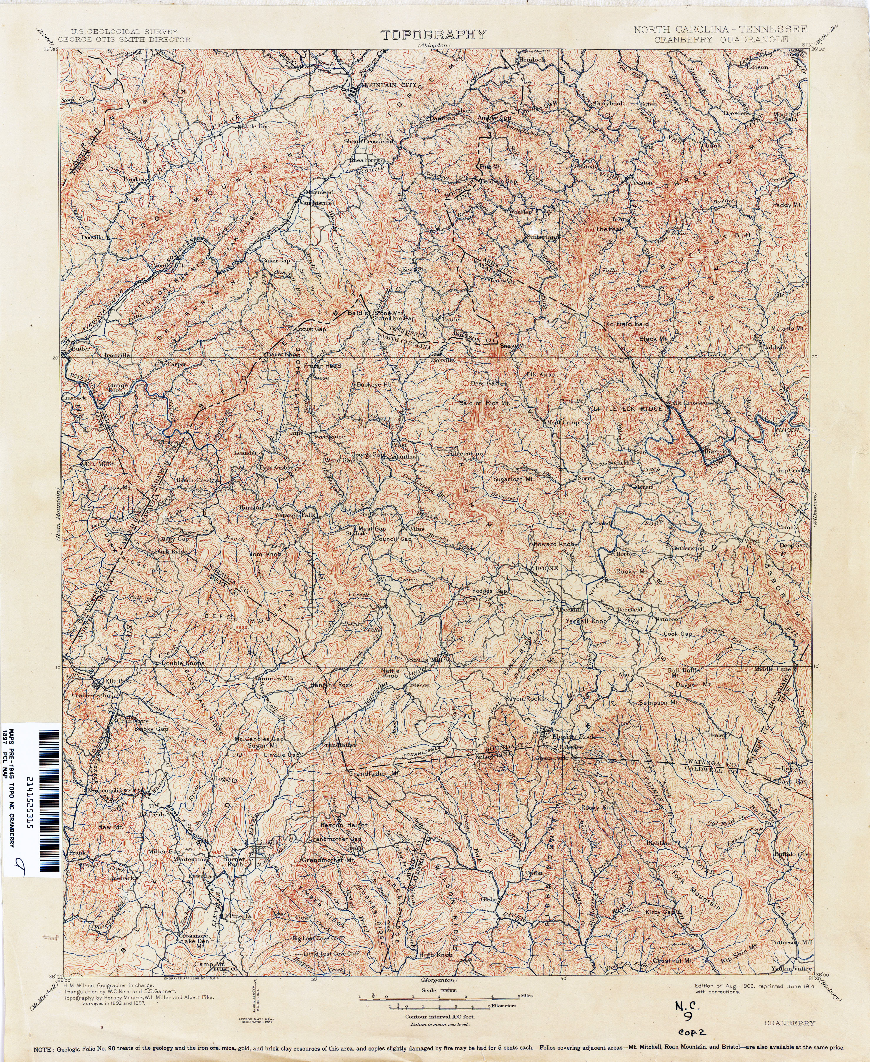
It was surreal to see what was missing one hundred years ago. Some towns weren't there. Many roads were dirt. I spent awhile looking at Watuaga County, where I've spent a lot of time over the past 16 years. I was fascinated that highway 194 was the main road from Boone to Avery County, not 105 as it today. Accordingly, the towns along 194 seemed more important on that map. 105 wasn't there, but a dirt road went as far as Shull's Mill. Shull's Mill is no more than a crossroads today, but on that map from the early twentieth century it was so important that, along with Boone, it was featured with an inset street map. One map of Charlotte pointed the way to Blowing Rock, though a dozen larger towns dot the highway to Blowing Rock today.
I spent several hours looking at these maps, becoming engrossed in how much I could tell about what life might have been like from them. At some point I was looking at western Watauga County, noticing that the road today still follows the same path out toward Watauga Lake. Except Watauga Lake wasn't there. I looked it up on Wikipedia and discovered that when the TVA dammed the Watauga River, they flooded the town of Butler, Tennessee. Suddenly images of a sunken town flooded my mind, as did memories of O, Brother Where Art Thou? and my wife's phobia of dead bodies in large bodies of water (they got there, she claims, because old graveyards lie at the bottom of lakes). I ordered a book on the history of Butler because it was so intriguing.
That reminded me of some online browsing I had done recently on the geology of Pilot Mountain, a peculiar monadnock I saw every day as a child in my hometown of Pilot Mountain, NC. A monadnock, I learned, is a mountain that rises suddenly and in isolation on a relatively flat plain. Here is the picture (of Pilot Mountain, coincidentally) on the Wikipedia entry:

After several days these two ideas, the sunken town and the monadnock, started to interact with each other in my mind. I began to see a relationship: Both were connected by the flatness of their environments--the surface of the lake and the plain surrounding the mountain. Both deviated from their surroundings in some way--one rising above and one sinking below. The one jutting up, in view for miles and miles, the other completely hidden from view despite the people driving boats and skiing directly above it.
I really liked the inversional, yin-and-yang relationship between these two things and began to think of how this relationship might be abstracted musically. The more I thought about the sunken town, the monadnock, and music the more I started see this in my mind:

Which is an abstraction of this:

Which is a sound wave.
See. Everything has a musical application.
So the title of this blog is a conflation of the two in a way that makes syntactical sense, though semantically it's paradoxical. More on the musical development of this concept next time.
No comments:
Post a Comment